
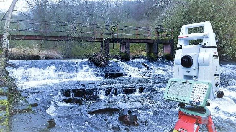
Hydrographic and Bathymetric Surveys for Accurate Data
Understanding what lies beneath the surface of rivers, lakes, harbours, coastal areas, and other water environments is essential for many engineering and construction projects. Hydrographic and Bathymetric Surveys provide detailed information about underwater features, water depths, seabed levels, and submerged structures.
Accurate survey data can support planning, design, dredging, marine construction, environmental assessment, and infrastructure development. For organisations working on projects across the UK, choosing an experienced surveying provider can help ensure that decisions are based on reliable information.
Apex Engineering Services provides surveying solutions designed to support engineering, construction, and property-related requirements.
What Are Hydrographic and Bathymetric Surveys?
Hydrographic and Bathymetric Surveys involve collecting and analysing data about underwater environments. While hydrographic surveying can cover a broad range of water-related features, bathymetric surveying focuses particularly on measuring water depth and mapping the shape and elevation of the seabed or underwater terrain.
The information gathered can be presented through detailed survey drawings, digital models, charts, and other project-specific outputs.
Mapping Underwater Terrain
Bathymetric data can show changes in underwater elevation, helping project teams understand the shape and condition of a seabed, riverbed, lakebed, or other submerged surface.
Identifying Submerged Features
Surveying can help identify underwater structures, obstructions, channels, pipelines, cables, and other features where appropriate survey techniques are used.
Supporting Engineering Decisions
Reliable underwater measurements can assist engineers, contractors, designers, and project managers when planning work in or around water.
Why Are Hydrographic Surveys Important?
Projects involving water require accurate information about existing conditions. Without suitable survey data, design assumptions may not reflect the actual underwater environment.
Support Marine Construction
Ports, harbours, bridges, offshore structures, and other marine developments may require detailed information about water depths and submerged conditions before work begins.
Assist Dredging Projects
Dredging involves removing material from underwater areas. Accurate bathymetric information can help establish existing levels and support calculations for planning and monitoring.
Improve Project Planning
Survey data can provide a clearer understanding of site conditions, helping project teams identify potential constraints and plan work more effectively.
Support Environmental Studies
Underwater mapping can contribute to environmental assessments and monitoring where information about seabed or riverbed conditions is required.
How Are Hydrographic and Bathymetric Surveys Carried Out?
The surveying method depends on the environment, project requirements, water conditions, and required level of detail.
Data Collection
Specialist surveying equipment can be used to collect measurements of water depth and underwater features. The technology selected depends on the project and survey objectives.
Positioning and Measurement
Accurate positioning is important when creating reliable underwater maps. Survey teams combine location data with depth measurements to build a representation of the surveyed area.
Data Processing
Collected information is processed and checked before being presented to the client. Depending on the project, outputs may include point data, contour information, plans, sections, or digital terrain models.
Quality Control
Survey data should be reviewed for consistency and potential errors. Appropriate quality-control procedures help ensure that the final information is suitable for its intended purpose.
When Do You Need Hydrographic and Bathymetric Surveys?
Different industries can benefit from accurate underwater survey information.
Construction and Infrastructure
Projects involving bridges, marine structures, drainage systems, or waterfront developments may require detailed information about existing water environments.
Ports and Harbours
Survey data can help support navigation-related planning, dredging, maintenance, and infrastructure projects.
Civil Engineering
Engineers may use underwater measurements when designing or assessing structures that interact with rivers, canals, lakes, or coastal environments.
Utilities and Marine Assets
Where underwater pipelines, cables, or other infrastructure is involved, surveying can help establish location and site conditions.
Connecting Marine Surveying with Building Survey Services
Engineering projects often involve both external site information and detailed information about existing buildings. This is where Measured Building Surveys Services can complement wider surveying requirements.
A measured building survey provides accurate information about a building's dimensions, layout, structural features, and architectural details.
Accurate Existing-Building Information
Measured surveys can provide reliable drawings and measurements for refurbishment, renovation, extension, and design projects.
Supporting Architectural Design
Architects and designers can use accurate existing-condition information when developing proposals and planning modifications.
Improving Project Coordination
Combining accurate building information with site and hydrographic data can help project teams develop a more complete understanding of complex locations.
Choosing a Surveying Company in the UK
Selecting the right surveying provider is an important project decision. Consider the company's experience, technical capabilities, equipment, reporting standards, and ability to meet your project requirements.
Relevant Experience
Look for a provider with experience in the type of environment and survey you require.
Appropriate Technology
Different projects require different surveying methods. A competent provider should be able to select technology based on the required accuracy and site conditions.
Clear Deliverables
Before commissioning a survey, confirm what information will be provided, including drawings, digital files, models, measurements, or reports.
Professional Support
Good communication throughout the project can help ensure the survey addresses the specific requirements of engineers, contractors, designers, and other stakeholders.
Why Choose Apex Engineering Services?
Apex Engineering Services provides surveying and engineering support for projects requiring accurate site information. The appropriate survey approach depends on the project scope, location, required accuracy, and intended use of the data.
Whether your project involves underwater mapping or Measured Building Surveys Services, discussing your requirements with an experienced surveying team can help identify an appropriate approach.
Frequently Asked Questions
What are Hydrographic and Bathymetric Surveys?
Hydrographic and Bathymetric Surveys collect information about underwater environments, including water depths, seabed levels, submerged features, and other relevant site conditions.
What is bathymetric surveying used for?
Bathymetric surveying is used to measure and map underwater terrain. It can support dredging, marine construction, infrastructure planning, environmental work, and other projects requiring underwater data.
What are Measured Building Surveys Services?
Measured Building Surveys Services provide accurate measurements and information about existing buildings, supporting architectural design, refurbishment, renovation, construction, and property projects.
How accurate are hydrographic surveys?
Survey accuracy depends on the equipment, methodology, environmental conditions, positioning systems, and project specifications. The required accuracy should be established before the survey begins.
Who needs hydrographic and bathymetric surveying?
Civil engineers, marine contractors, developers, environmental professionals, infrastructure owners, ports, and other organisations may require underwater survey information for specific projects.
Get Reliable Survey Data for Your Next Project
Accurate site information is essential when planning construction, engineering, infrastructure, and marine projects. Hydrographic and Bathymetric Surveys can provide valuable insight into underwater terrain, water depths, submerged features, and existing site conditions.
For projects that also involve existing buildings, Measured Building Surveys Services can provide complementary information to support design and construction decisions.

 Arabic
 French
 Spanish
 Portuguese
 Deutsch
 Turkish
 Dutch
Dutch
 Italiano
 Russian
 Romaian
 Portuguese (Brazil)